Over 1.082.000 registered users (EN+CZ). New 1D nesting and 3D nesting tools, updated Color converter. New AutoCAD 2025 commands and variables. Learn about twiGIS.
 CAD tip # 8361:
Question
You will need an annotation block with one (or first) attribute for the future number (vertex ID) and optional other attributes - e.g. for coordinates XY, XYZ or just Z. An example of such block can be downloaded from the Catalog - see VertID:
Now import this block into your drawing (Insert) and load (Appload) the two LISP utilities VerticesBlk and InsertC (see Download).
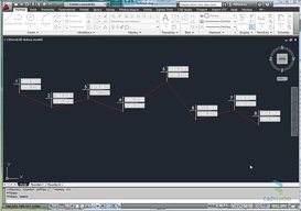
First start the VerticesBlk command to insert the VertID block to all vertices of your polyline (LWPolyline, 3D Polyline etc.). Then start the BlockC command to renumber the labels with a series of incrementing numbers.
See the detailed procedure (Czech version) in the AutoCAD video #46

or on the CADstudioCZ channel on YouTube:
or see this animated GIF (click to enlarge):
![CAD Forum - tips, tricks, discussion and utilities for AutoCAD, Inventor, Revit and other Autodesk products [www.cadforum.cz] CAD Forum - tips, tricks, discussion and utilities for AutoCAD, Inventor, Revit and other Autodesk products [www.cadforum.cz]](../common/arkance_186.png)


