 CAD tip # 7396:
Question
1. First method:
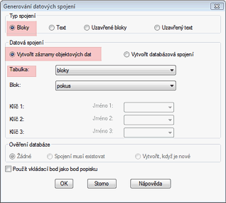
In the object data definition (ADEDEFDATA, Map > Define object data) choose "Create new table" to create a blank table containing identical items as the existing block attributes (tags). No default values are neccessary. Then start the ADEGENLINK command (Generate links, Map > Database) and set its dialog similarly to the picture. Select the appropriate linkage type (Blocks), under "Data Links" select "Create Object Data Records", choose your defined table, choose block, select OK. The links are generated automatically and the attribute values are copied into object data (OD).

2. Second method:
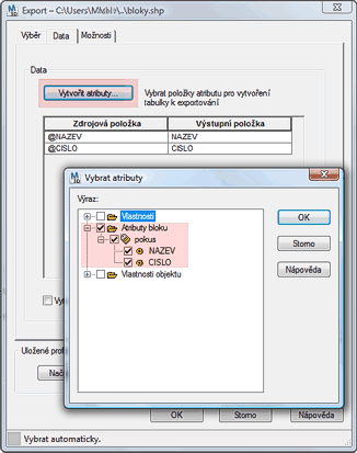
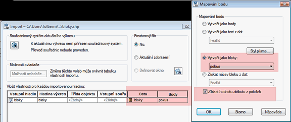
If you want to "cheat" and you don't want to define tables, just export (MAPEXPORT) the blocks to an ESRI shapefile (SHP) while using the OD option, erase the blocks and then re-import the shapefile into AutoCAD Map (MAPIMPORT) - when the import dialogue shows up, choose to import data in the OD tables under the Data column (see the "..." button) and set point mapping to blocks (the last column). This will automatically create tables and the desired fields, you just have to play around with modify the tables.


![CAD Forum - tips, tricks, discussion and utilities for AutoCAD, Inventor, Revit and other Autodesk products [www.cadforum.cz] CAD Forum - tips, tricks, discussion and utilities for AutoCAD, Inventor, Revit and other Autodesk products [www.cadforum.cz]](../common/arkance_186.png)


